Carcavelos
Carcavelos was, until 2013, a civil parish in the Portuguese municipality of Cascais, about 12 km west of Lisbon. In 2013, the parish merged into the new parish Carcavelos e Parede. The parish was known for the Carcavelos wine. With the decline of the winemaking industry in the region, the attractiveness of its beaches have made the parish a destination for surfing, due to the waves here.
At the mouth of the Tagus River and east of the main beach is the fortification of Fort of São Julião da Barra. It was used to protect the Tagus from enemy ships, but in the 20th century it became the official summer residence of the Minister of Defense.
In the 19th and 20th centuries, Carcavelos was an important landing point in the international telegraph network, providing crucial communication links for the British Empire; most of the links were run by forerunners of the Cable & Wireless company.
Carcavelos is home to a number of international schools including Saint Julian's School, and Nova School of Business and Economics.
* Carcavelos DOC
Map - Carcavelos
Map
Country - Portugal
 |
 |
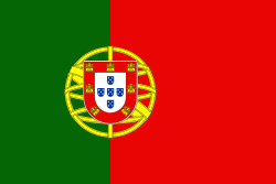
| Flag of Portugal | |
One of the oldest countries in Europe, its territory has been continuously settled, invaded and fought over since prehistoric times. The territory was first inhabited by pre-Roman and Celtic peoples who had contact with Phoenicians, ancient Greeks and Carthaginians. It was later ruled by the Romans, followed by the invasions of Germanic peoples and the Islamic invasion by the Moors, whose rule was eventually expelled during the Reconquista. Founded first as a county of the Kingdom of León in 868, gained its independence as the Kingdom of Portugal with the Treaty of Zamora in 1143.
Currency / Language
| ISO | Currency | Symbol | Significant figures |
|---|---|---|---|
| EUR | Euro | € | 2 |
| ISO | Language |
|---|---|
| PT | Portuguese language |


